
HIGH PEAK
RAILWAY WALKS
(Upadate: June 2017)
MIDDLETON BOTTOM To MIDDLETON TOP
Edited June 2013
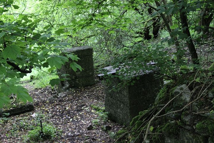
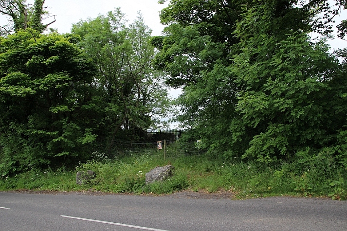
On
the road up from Wirksworth to where I joined the Incline I came
across these concrete base stones, which I believe are the remains
of
the Rope-Way that went from Middleton Quarry across
to Middlepeak Quarry. It was this rope-way that put the
quarry branch out of use.
Updated June 2016.
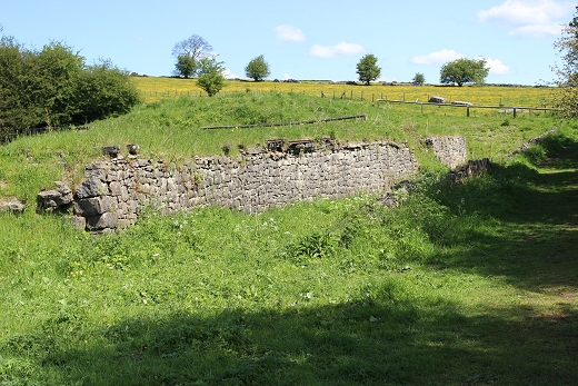
Another
visit to Middleton Top on the 16th of June 2016. While
walking up the hill towards Middleton you pass the opening that
leads into the site of what
was the short quarry branch that came off at Middleton Bottom. I
have visited the site from that end and passed this entrance a few
times but this is the
first time that I noticed that there were still a section of track
still in place, just where the stop block of the siding was. The
rails look very old.
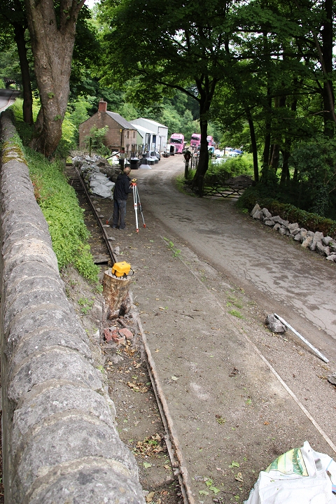
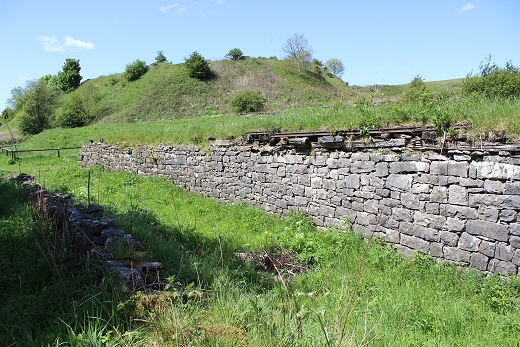
This
is still a working site and also a private dwelling. I did
not go beyond this entrance. The section of track is behind
me, on the left. The business here deals with Marble and Granite
stone.
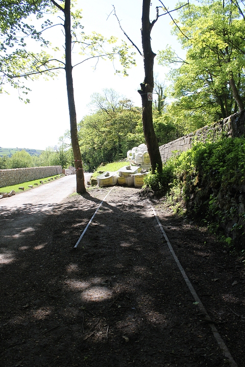
This looks rather wide and I wonder if it
isn't the remains of two lines that may have ran side by side,
originally!
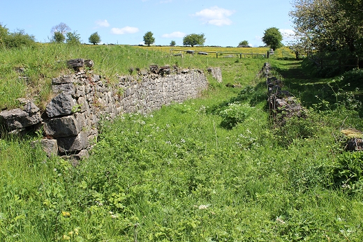
Left:
The track stops short of where it came in from Middleton
Bottom.
Right: From the quarry entrance, towards the Middleton-Wirksworth
road where the branch entered Middlepeak Quarry.
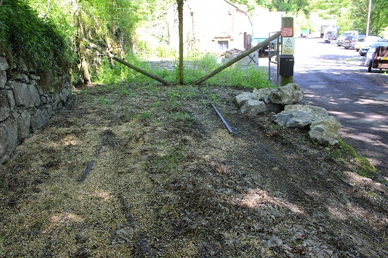
The
stop block was where the large, yellow bags are laying across the
track. The Middleton
road climbs up behind this, to the right. N.B.
I have since learned that the track continued
across the road and into Middlepeak quarry. 24th June 2017.
========================================================
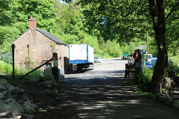
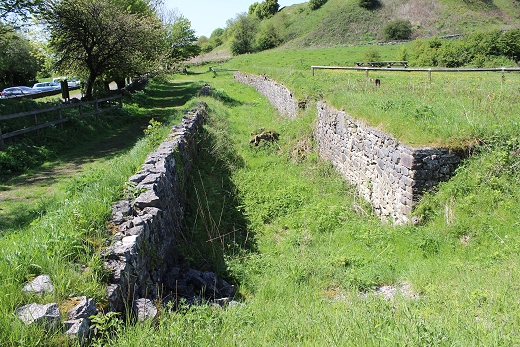
Update 24th June 2017
It seems you never stop learning! While
passing this spot on the 24th June, 2017, I came across two chaps
working at the entrance
to the old quarry branch as it came off at the bottom of the
Middleton Incline..From this I
learned that the track didn't stop at this
point but originally crossed the road and into the
site of Middlepeak Quarry. After the closure of the branch the
Middleton Road
was redesigned and the gradient leveled to suite the new
formation. It was also nice to have learned that the owner of this
land
fully intends to keep the track in place at this spot.
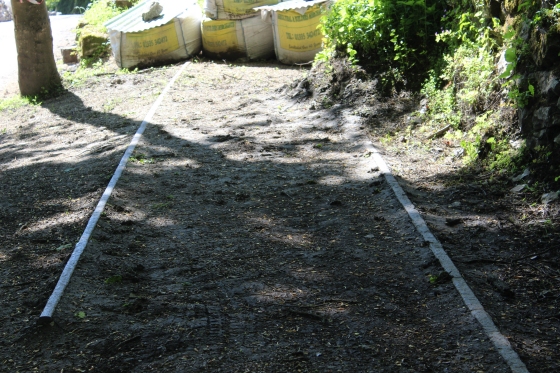
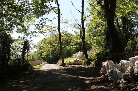
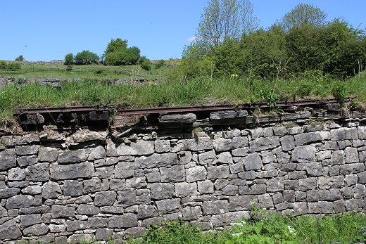
From the
Middleton Road, with the remaining quarry branch track still in
situe.
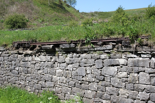
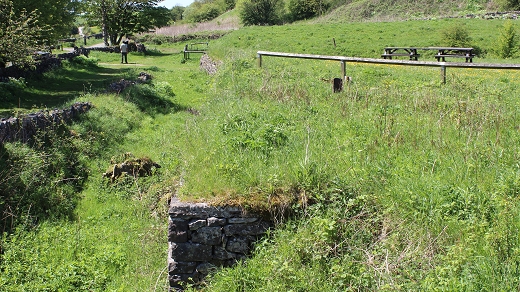
There the quarry
branch crossed the road and entered Middlepeak Quarry. Here the
track bed has been in-filled and the road
incline redesigned for it's present use.
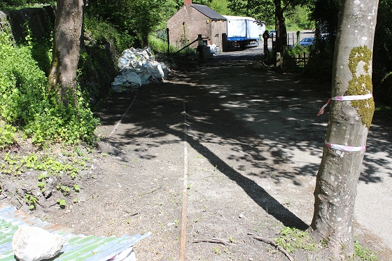
Standing at the spot
where the track bed came out of Middlepeak Quarry and up to the
junction at Middleton Bottom.
===============================================================
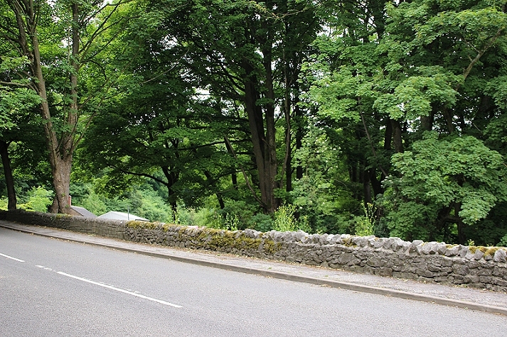
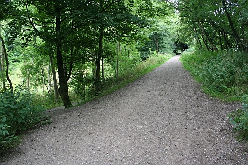
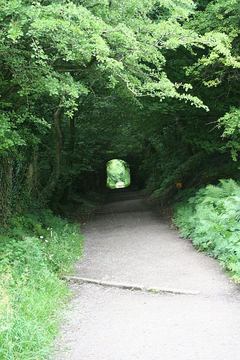
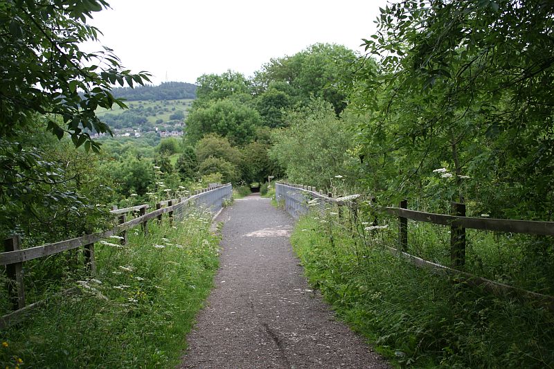
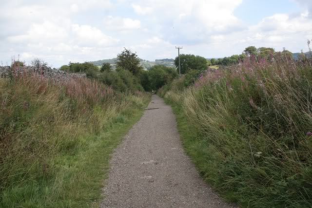
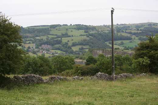
From
Wirksworth to the incline over bridge at Middleton Bottom. I joined
the track bed from the unofficial path on
the right by the lampost. Looking towards Middleton. You
can catch the 6.1 bus from Wirksworth (Hourly) but the
stop is way up ahead, beyond the Spread Eagle Inn, with a longish
walk, either back to this spot or walk up to
Middleton Top. This is only a 10-12 minute walk from
Wirksworth and about the same again up the
incline to Middleton Top. It is all on an incline. (June
2016).
==========================================================================================
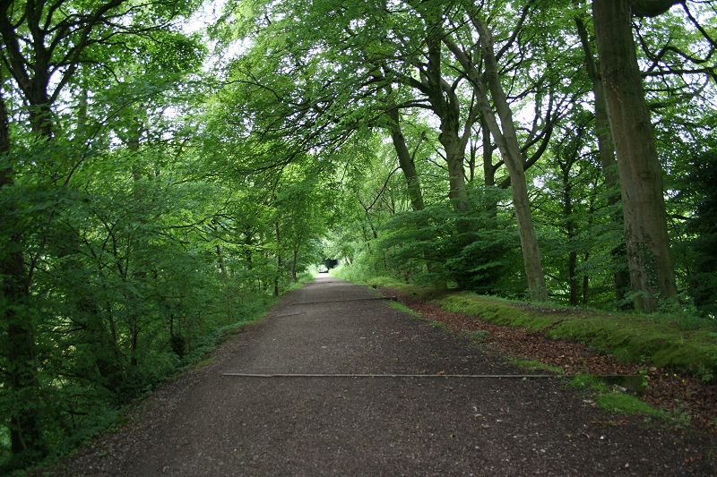
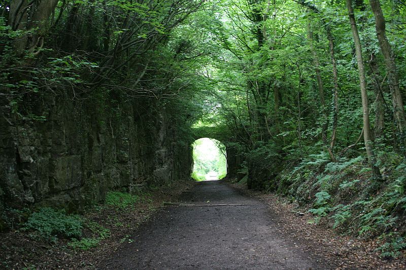
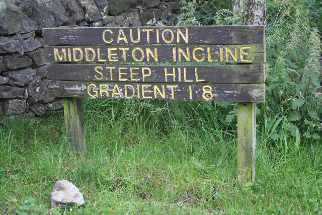
Continuing up the Incline...............
Middleton
Bottom. The winding wheel is within the fenced off area on the left.
The short
quarry branch ran off to the left of that and into the tree line,
while the incline climbed off
to the right of this. Aug. 2011.
This where I joined the track for my
visit to Middleton Top on the 24th Aug 2012 and again
when walking from Wirksworth to Parsley Hay on the 25th of August
2012.
Looking up the incline towards the high farm over bridge.
Looking up the incline from
Middleton Bottom
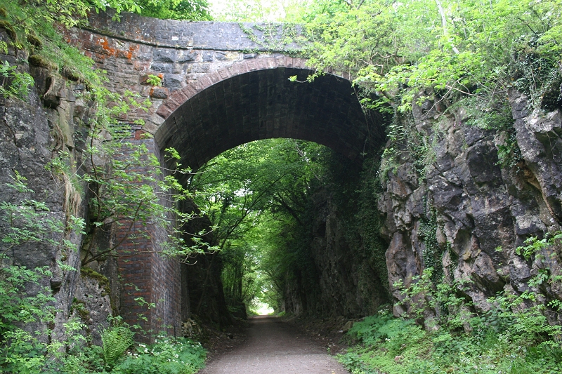
The Farm track over
bridge on the Incline. Looking towards the summit. (May 2012)
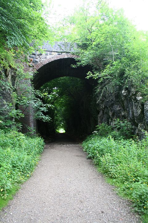
A 1961 photo close to
the same spot as the 2011 one on the left. I'm wondering what the
strange rock formation on the top of the bridge was for and
how safe was it! It is no longer there. (D. J. Norton).
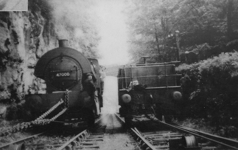
Around the same spot.
Saddle Tank 47000 descends the incline with a water tank ascending as
counter balance. Locos would not
have been allowed to work by themselves on this steep gradient.
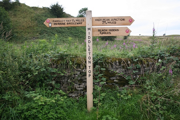
The sign
up ahead on the right points to the path that I would have taken to
join the track
bed at this point.
The bus stop is just a minutes walk up the left hand side of this
bridge.
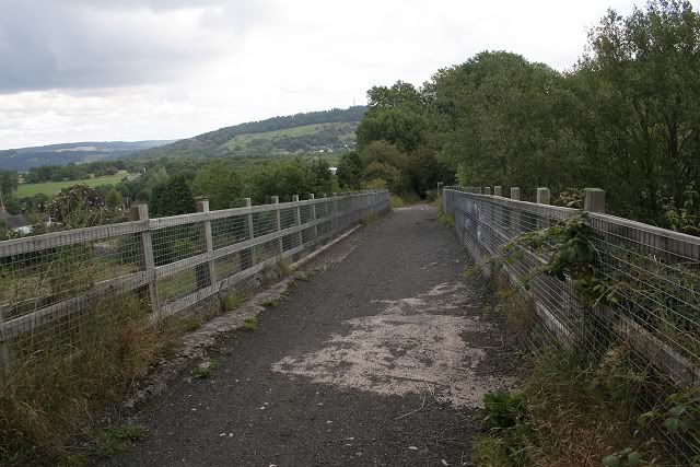
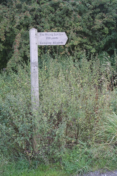
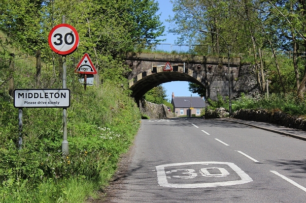
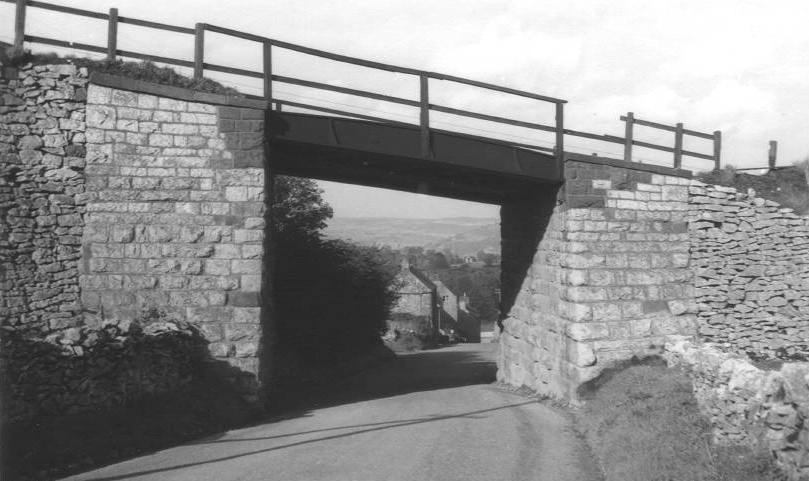
The railway bridge over the B5035.
The signpost indicates the short walk to the Rising Sun Inn at
Middleton. That would have been nice if I had had the time for a
visit. (Aug.2011)
N.B. On passing the Rising Sun Inn on the
24th June 2017 I found it completely boarded-up. I have no
idea if this is permanent or possibly until a new
management takes over.
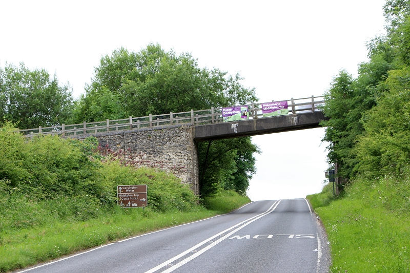
The
railway over bridge over the B5035. East side looking towards
Hopton. (24th June 2017).
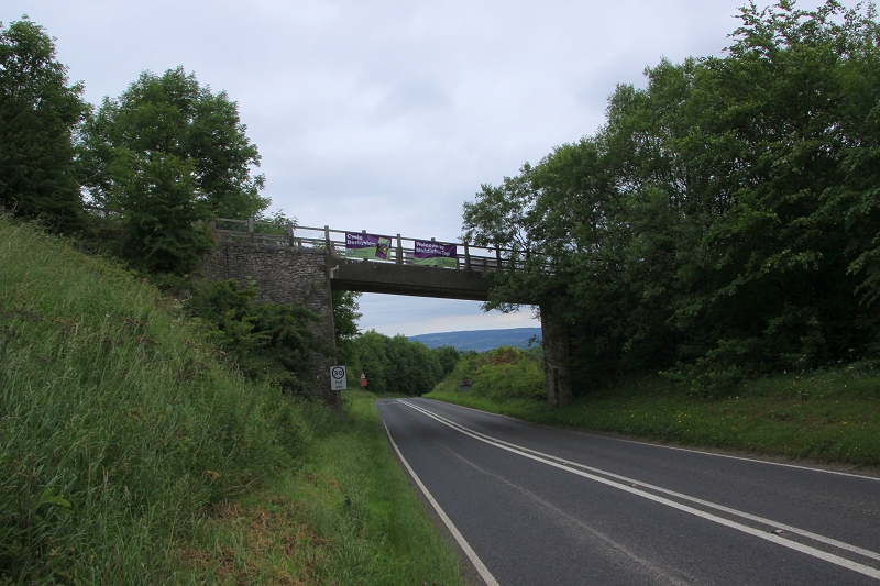
Railway
over bridge over the B5035. West side, looking towards
Middleton (just around the bend). (24th June 2017).
The top of the incline
looking down to Middleton Bottom (Aug.2011).
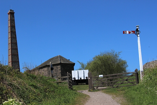
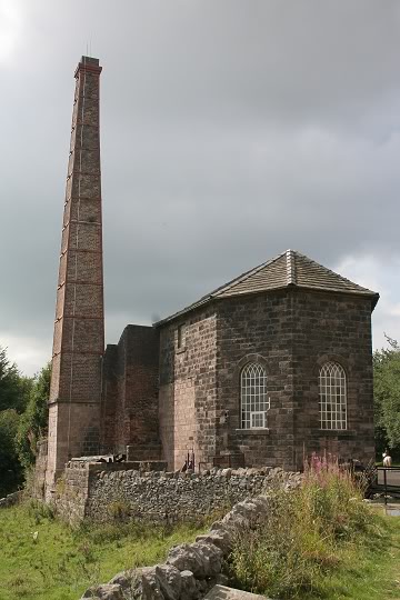
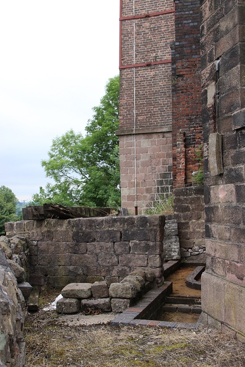
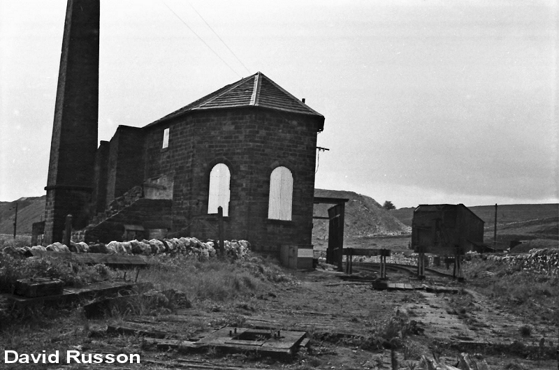
The
rear of the engine house as seen from the road leading up to
the site entrance. (24th June 2017).
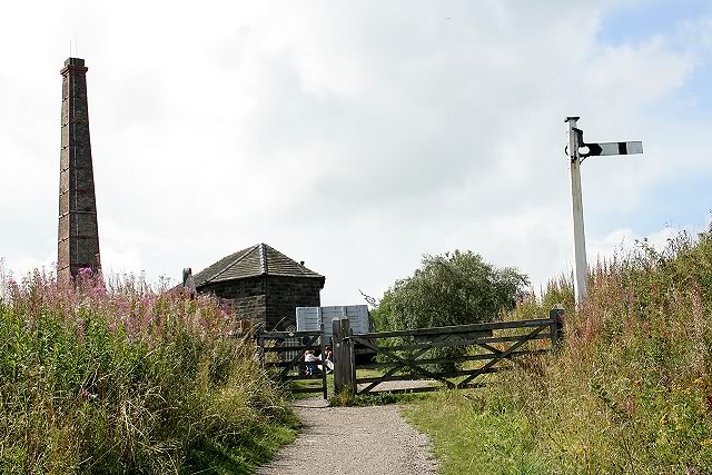

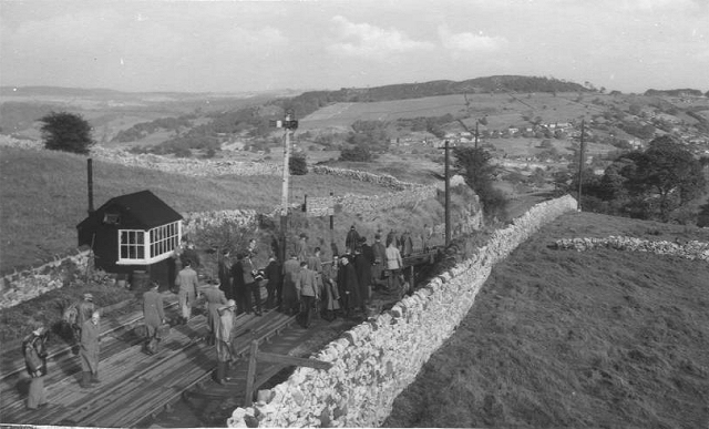
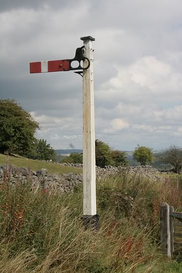
Left: At The Summit
Middleton Top (Aug
2011).
Right:
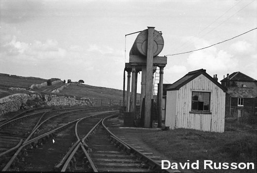
requires reduced size file Right:
16th May 2016. The signal has been changed. However they have the
signal arm back to front!

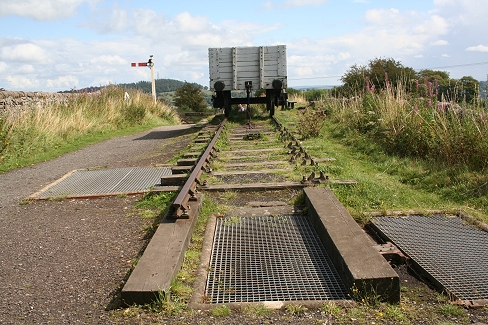
Wagons waiting for the descent. Note
the wheel block by the left side wheel.
(Author Unknown)
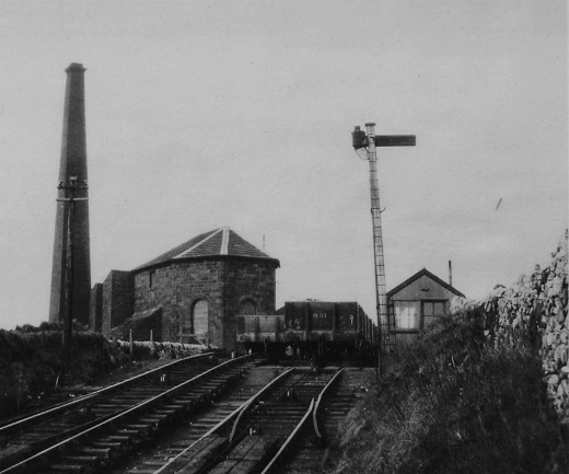
From
almost the same spot. Right: 24th June
2017.
Right: When the railway was fully working.
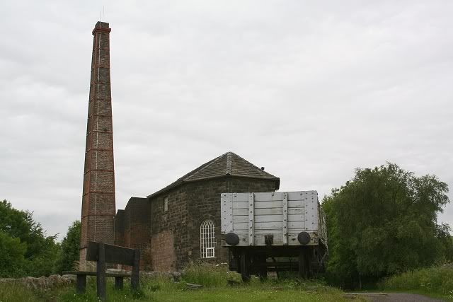
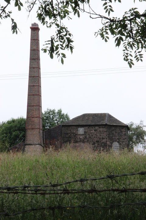
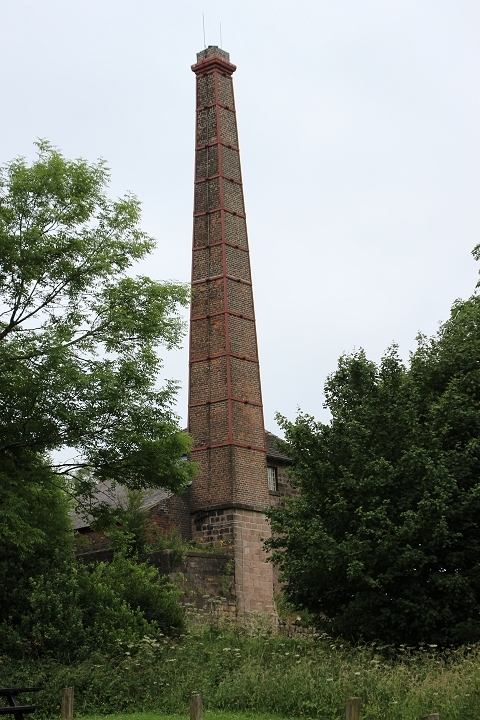
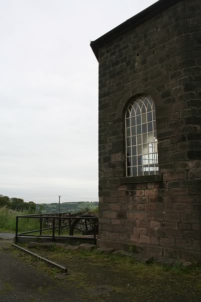
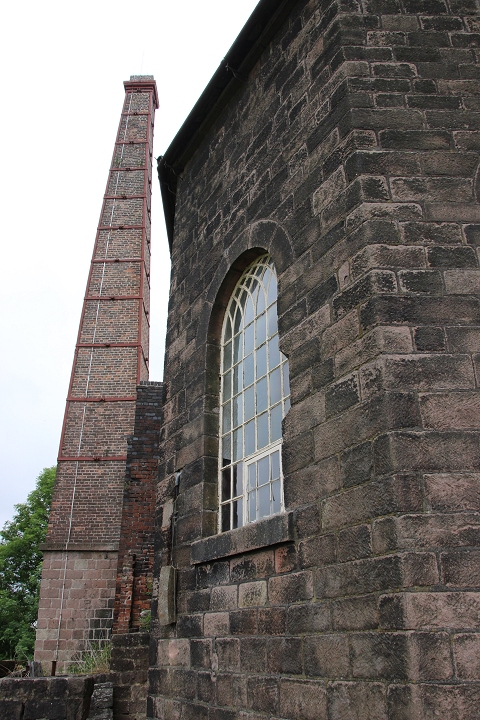
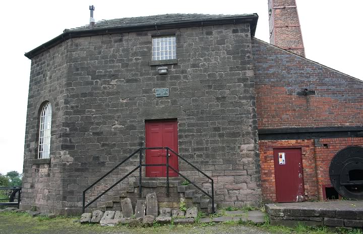
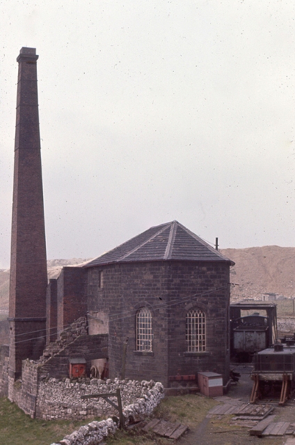
The Engine House.
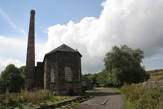
The Engine House. (27th Aug 2011)
Left: The Engine House and the
decorative windows. (27th Aug.
2011).
Right: From the Engine House window. April 1967.
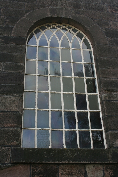
The decorative window frames
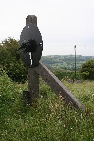
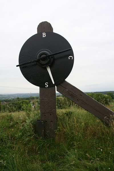
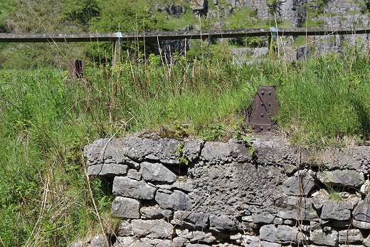
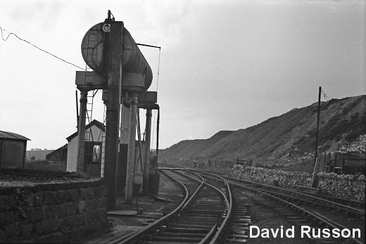
This indicator was linked directly
to the main wire and gave a true indication where the wagons were
anywhere on the gradient.
This notice board can be seen to the
right of the signal in the photo below.
1961. Middleton Top
Engine House (D. J. Norton)
The starting signal for the
incline is still standing. (Aug.
2011).
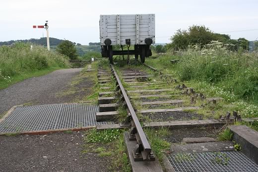
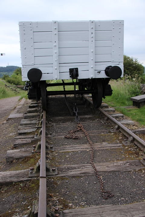
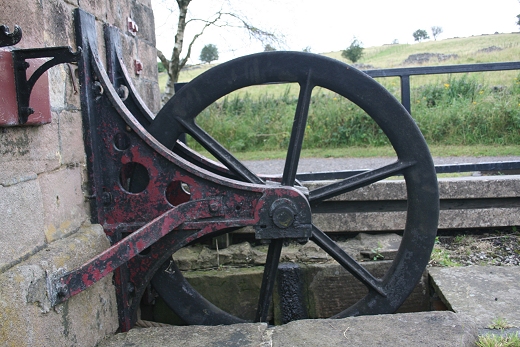
This wagon sits by the wheel pit and gives a demonstration of how the
wire was attached.
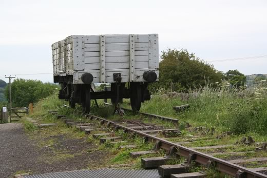
The
Hanging On Chain is well displayed
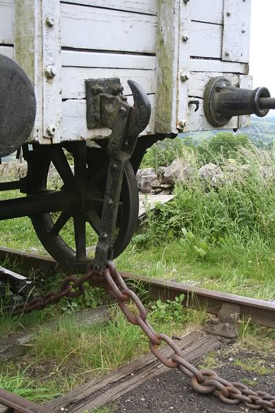
Left: The wagon coupling and chain.
The chain also wound around each buffer to give added strength and
balance the pull on the drawbar. Right: The Wheel Pit and the
demonstration wagon. N.B. The possible Wheel axel lubricator between
the two grids in the foreground right. See Below. Also seen just up
ahead is a sole remaining
Wire Guide Fitting in the four-foot. See two photos below. (Aug. 2011)
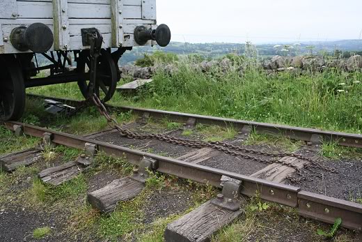
The
Hanging-On chain. (24th June 2017).
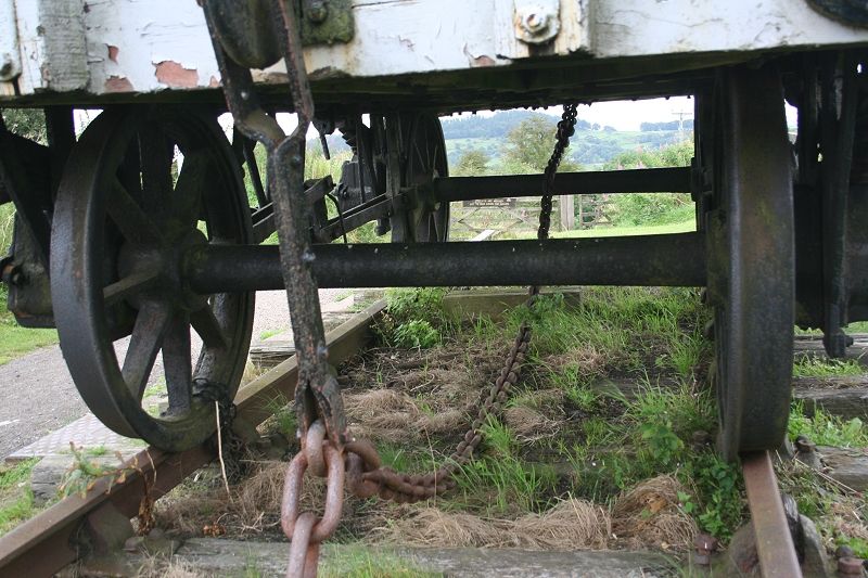
This shows the
weight of the chain linking the two ends of the wagon sole bar.
(24th Aug. 2012)
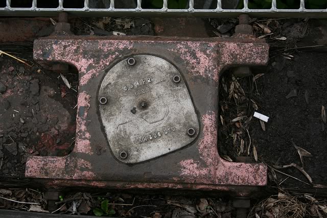
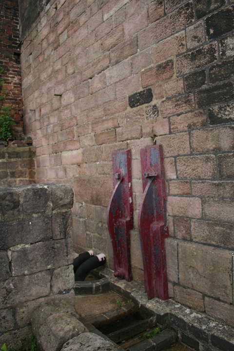
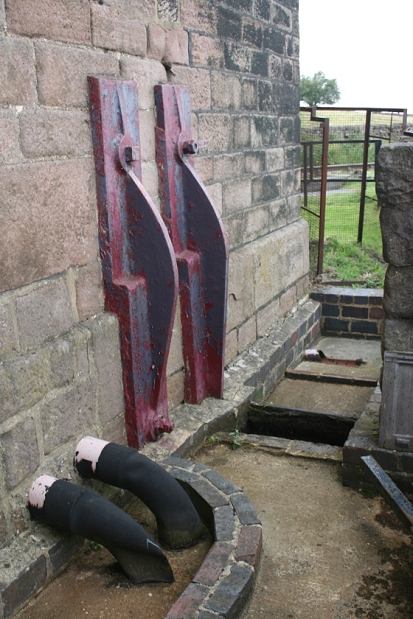
The large wire wheel axel fits into
this interesting object and must have been for servicing &
lubrication of the axle
bearing . It is dated 1829.
There doesn't appear to
be many of these still remaining. The wire cable guide wheel fitted
onto this. It would be nice to see
a completed one at this site. (Aug. 2011). In the official video set
it shows this pot with it's wheel and cable running over it
and being used for demonstration. It's a pity the wheel and wire was
removed.
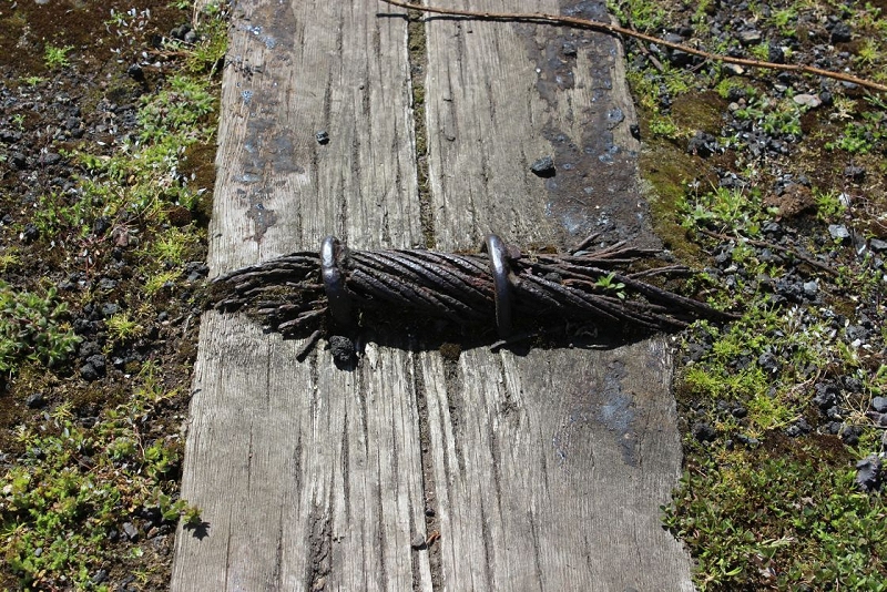
A
piece of the wire rope is fixed to a sleeper, for display. 16th May
2016.
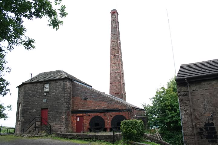
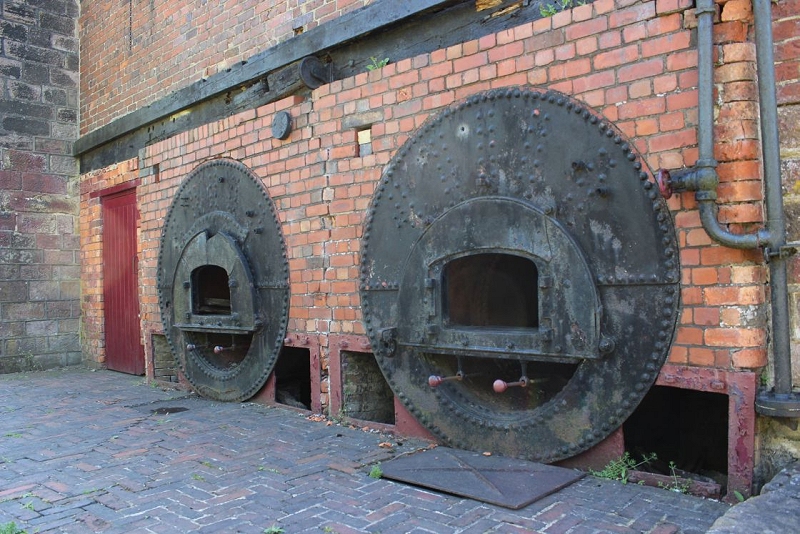
The Engine House (Side Views)
Off-side
photos of the engine house. 24th June 2017).
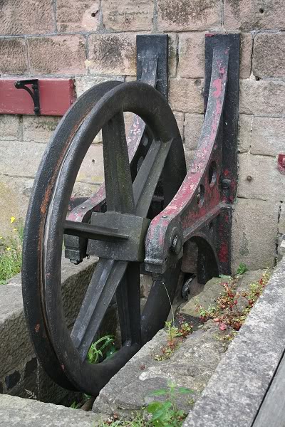
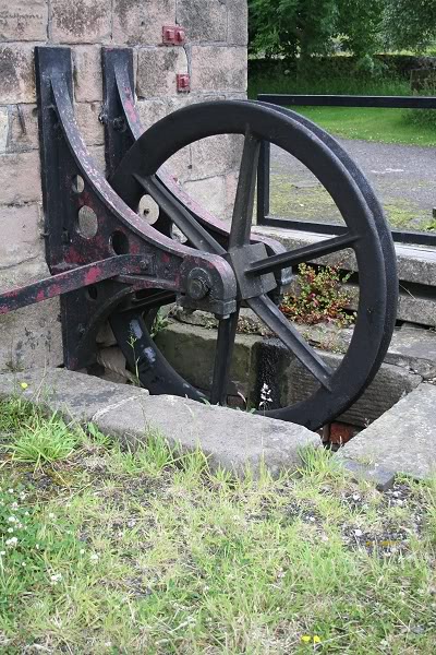
The wheel outside the
engine house where the wire was channeled onto the big wheel. On the
left you can see the rope that turns this wheel
during the engine demonstration.
Side View (24th Aug. 2012).
The Steam Engine
outside wall fixtures. (24th Aug. 2012).
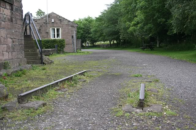
Site of the old Loco Shed and water
tank (Looking North). Note, the two short sections of rail are
standing on
single stone sleepers.
I'm standing on what would have been
within the single track loco shed
The wooden locomotive shed stood
level with the side of the house. The house has also changed
considerably, according
to the 1960's photo below. N.B. From the photo below it is seen that
the upper windows of the house have been changed
from a single to two windows.
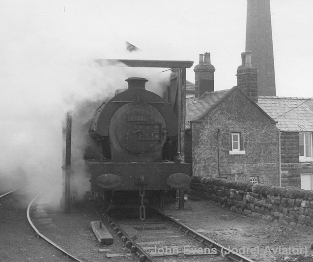
1960's photo of a
Saddle Tank loco standing on the shed road. The shed originally had a
substantial roof. The
situation as above couldn't have offered much protection. The loco too
appears in the same grimy state that
most mainline steam locomotives were at this time as full
dieselisation of B.R. was within a year away,
which also probably played it's part in this line being closed. (John
Evens).
Not
in file 8012AtMiddletonTopTibshelfFlickr.jpg
A very good quality
colour photo at the same spot. Saddle Tank
608012 looks nice and clean too. (Tibshelf (Flickr)
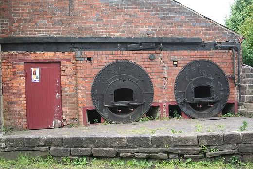
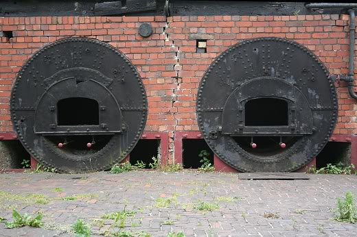
The boilers are in the open but
originally did have a roof over them at some stage.
New
photo 16th. May 2016.

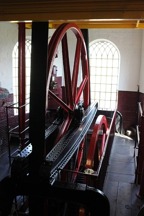
Static
Steam Engine at Middleton Top. (D.W.K
Jones).
Right: From a similar angle. during the Open Day 26th
August 2013.
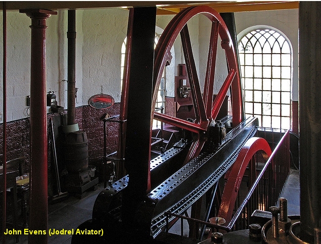
The engine is still ran
a number of times throughout the year. Worked by compressed air.
MIddleton Engine Video (Gaz111h YouTube) Middleton Engine (Video) (gwaithwyr YouTube) Middleton Engine Video (millefleurx YouTube)
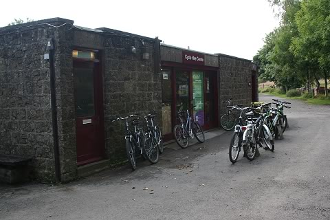
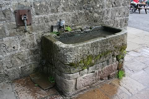
Left:
The Bike Hire
Shop.
Right: An
original Horse Trough. Still used by Horses and Dogs. (Both Aug.
2011)
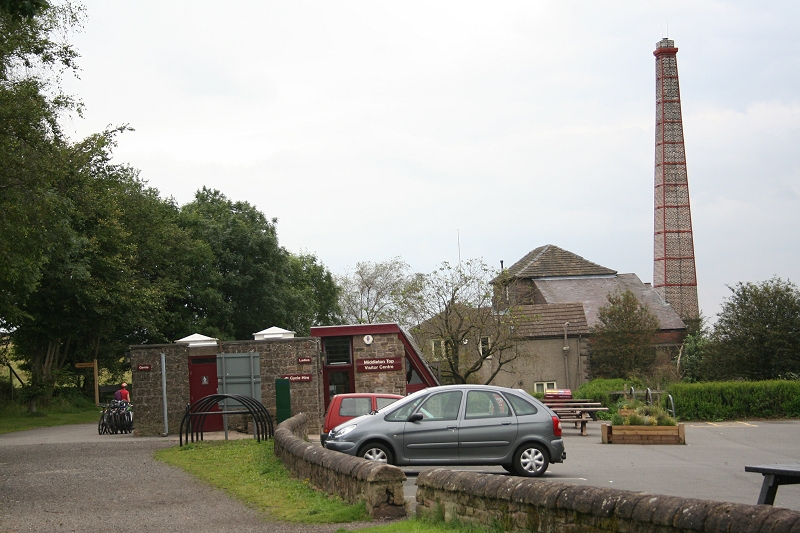
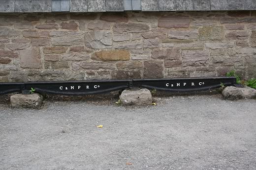
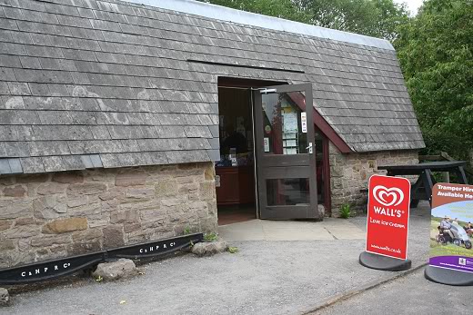
Visitor Center, bicycle hire, shop
and conveniences with the Engine House behind. Aug. 2012.
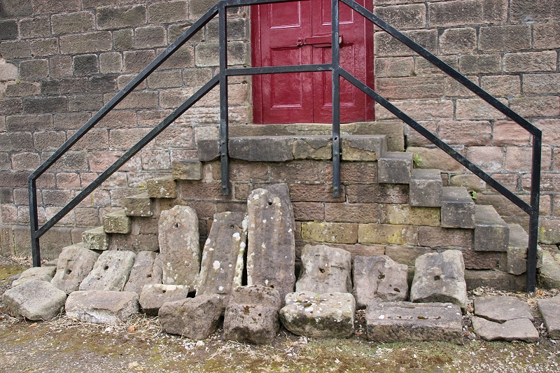
Original Fish Belly
rails resting on individual stone
sleepers.
These are demonstrated alongside the information office and shop.
Fish-belly
rails and stone sleepers. 24th June 2017).
Individual stone sleepers by the Engine House door way. 24th June 2017).
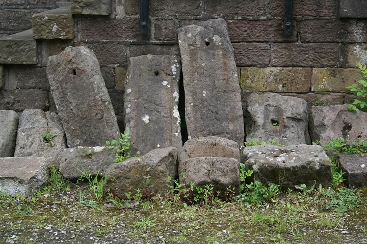
Individual stone
sleepers.
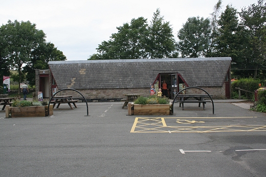
Visitor center and
station house from the picnic area. (Aug. 2012).
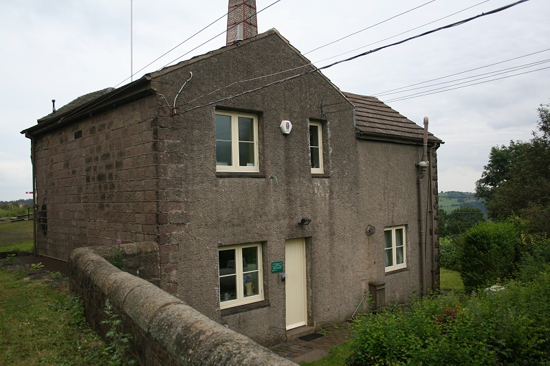
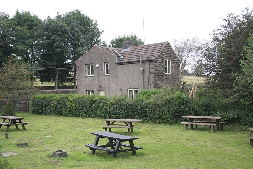
The Ex Station
House.Aug. 2012.
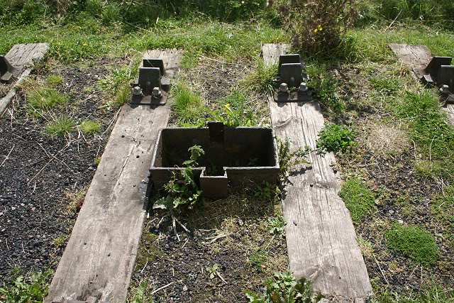
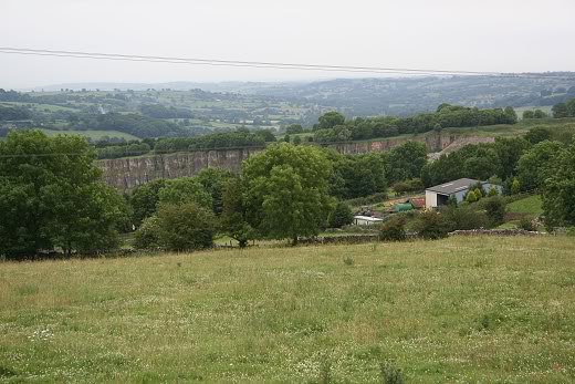
Redhill Quarry (Middleton Top)
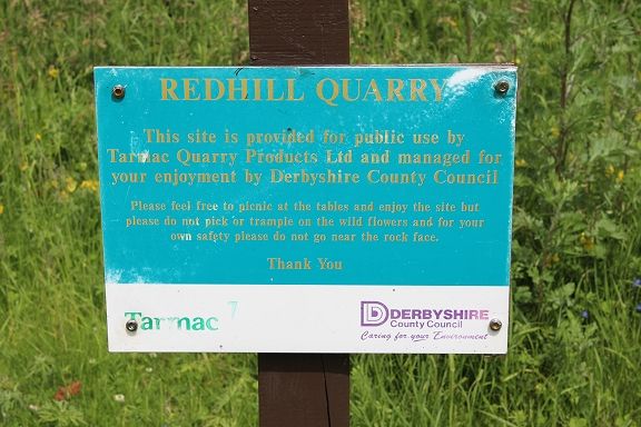
At Middleton Top there was a small
quarry called Redhill that had a siding with a loading
platform. (May 2012).
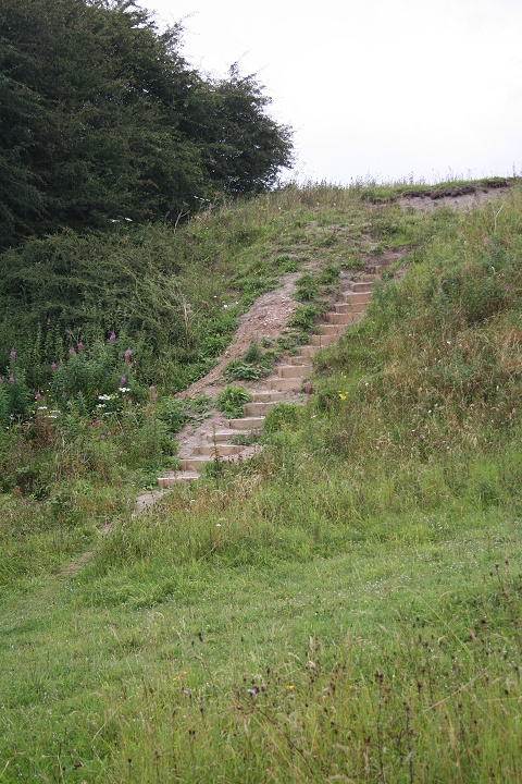
Workmen's steps still
usable today. Above three photos from 24th Aug. 2012.
The loading bay. New photos. 16th May 2016.
A narrow gauge
track ran along the top for tipping stone into the railway wagons.
Views
looking northwards alongside the main running line, on the left by
the cars.
Left: The crushing plant stood on the
right.
Right: Remains of the narrow gauge stop block.
David's
photo shows the crushing plant, sitting above the loading siding. On
the right. N.B. The stop blocks on the main running line. The
incline had
seased working but the line northwards continued in operation for
some time afterwards. As it did from Middleton Bottom towards Sheep
Pasture and
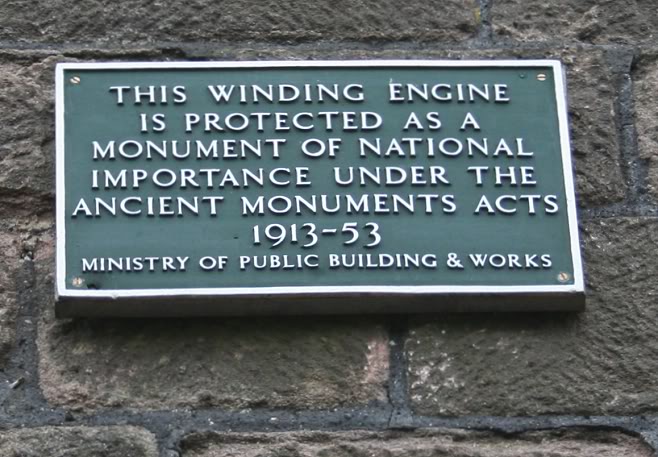
High peak Goods. This period is what helped the engine house
and engine to be preserved. All the other engines houses
were demolished at the time
of their closure. However, it's believed parts of the Bunsell and
Hopton engines were used for replacements to the Middleton
Engine.
Middleton Top Site from the slag
heap. April 1967. (John Evens). On the left you can see the railess
loading platform (above). The stone crushing
building is seen on the far left.
Left: By the water tank. Towards the
summit.
Right: Towards Hopton. (Photos by David Russon).
Views from Middleton Top
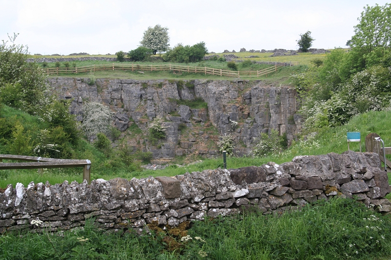
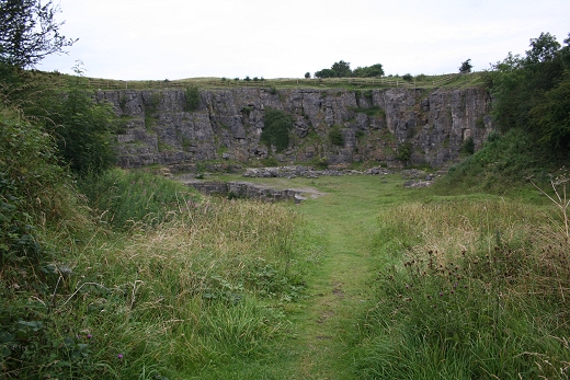
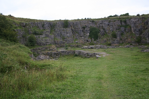
picnic area. Midpeak Quarry below. Known locally as "The Big Ol'e".
Part of the site is now a nature reserve.
Way board at Middleton Top. Aug.
2012.
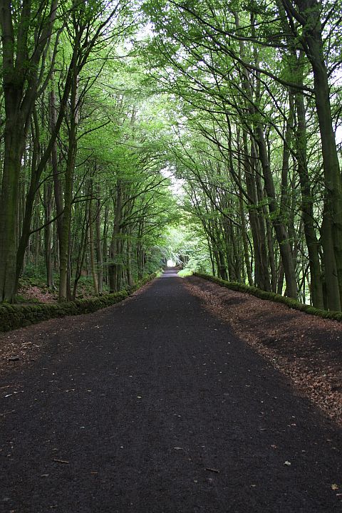
The track bed continues
northwards to Hopton incline and then the 11 miles to where the High
Peak Trail meets the Tissington Trail at
Parsley Hay, then to the end of the Trail at Hurdlow.
=====================================================
To MIDDLETON TOP TO HOPTON SUMMIT
My Thanks To.....
John Neave for his kind permission to use a number of his 1960's photographs when the railway was still in operation. Check out John's ''Going Loco'', which includes a C&HPR history. At....
http://goingloco.neave.com/Mark Norton for the use of 1940's photos by his late father Dennis J. D. Norton. http://www.photobydjnorton.com/CHPR_Menu.html#Links
John Evens for the fantastic colour photos taken in April 1967 just prior to the line closing. John's photos can be viewed on Flickr under JodrelAviator.
David Russon for the use of his B&W photos.Reading: The Cromford & High Peak Railway" by John Marshall. Published by Martin Bairstow. Printed by The Amadeus Press.
Other Railway Walks....
The Dundee & Newtyle Railway The first passenger railway in Scotland built in 1831, which had three inclines operated by stationary steam engines. The main source of income was from
the numerous stone quarries in the area and local farming produce. Passenger numbers were always sparse.
The inclines were abandoned in the mid 1800's by new deviations that allowed through locomotive running.
The line also included the Dundee Law (Hill) tunnel built at 300ft above the City. Both the north & south portals of the tunnel are buried below modern housing schemes.
Passenger services ended in 1955 and the line closed completely in the mid 60's.
Unlike the C&HPR none of the Engine houses were preserved. The inclines can still be followed but sections have been back-filled or ploughed over
This web site tries to cover as much as possible.Boddam To Ellon Branchline Built by the GNSR in the latter part of the 20th century. The passenger service only lasted until 1934 but goods remained up to total closure in 1949.
The GNSR built a large Golf course and Hotel at Cruden Bay, with an electric tramway between the station and hotel. All that remains today is the Golf course.Other web pages....
Kittybrewster Memories. Kittybrewster Loco Depot, Aberdeen.
Tivoli Memories The Tivoli Theatre, Aberdeen.
Hosted by www.theatreorgans.com